DOI: 10.14714/CP101.1817
© by the author(s). This work is licensed under the Creative Commons Attribution-NonCommercial-NoDerivatives 4.0 International License. To view a copy of this license, visit http://creativecommons.org/licenses/by-nc-nd/4.0.
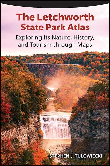
Review of The Letchworth State Park Atlas: Exploring its Nature, History, and Tourism through Maps
By Stephen J. Tulowiecki
State University of New York Press, 2022
239 pages, 90 maps, 35 photos
Softcover: $29.95, ISBN 978-1-4384-8950-6
Review by: Daniel G. Cole, Smithsonian Institution
New York’s Letchworth State Park, often referred to as the Grand Canyon of the northeastern United States, follows the course of the Genesee River as it flows north through a deep gorge and over several large waterfalls in the western part of the state. This year, the State University of New York (SUNY) Press has brought forth the first comprehensive atlas of this 116-year-old park, authored by geographer Stephen Tulowiecki. While the author lists ninety maps, many of the individual items listed are time series maps, overlapping large scale maps, or comparisons between different features at the same scale, so the number of individual maps assembled is in actuality quite a bit larger than claimed.
In his preface, the author points out that his creation of this atlas both “addressed an absence of maps that explore the many facets of the park” (xx), and involved other professional and personal reasons, such as his memories of past visits to the park (xix). He sees the “collection of thematic maps” that make up the atlas as providing a “geographic perspective on the nature, human history, and tourism of Letchworth State Park” (1). This review will evaluate how well he succeeded in that effort.
The first 11 maps in the book appear in Chapter 1, “Overview of the Park” (10–17), and consist of a sequence of four overlapping air photos from 2019 (Maps 1a–d) facing four topographic maps (Maps 2a–d) of the same areas, with their contents trimmed to the park boundary. The parts of the air photos outside the park boundaries are lightly masked, focusing attention on the park lands themselves and echoing the hard edges of map information shown on the topos. Given that the course of the Genesee River differs slightly between the air photos and undated topo maps (see especially 1c versus 2c), the two sets may not be quite contemporary. A bar scale that appears in the lower right of the images might have been better placed on the reference maps, but otherwise the cartography is clear and easy to read.
The next several maps locate the park in a variety of manners and contexts, and at different scales. Map 3 (18) is a simple map of the Earth in an orthographic projection (i.e., as seen from space), with Letchworth positioned in the center. Map 4 (19) zooms in to the state of New York and nearby areas, presenting a five-class rendering of population density using 2018 Center for International Earth Science Information Network (ciesin.org) data, effectively illustrating how close various population centers are to the park. The next six maps are illustrated in grayscale. Map 5 (20), at a scale of 1:500,000, shows hamlets, villages, and cities with major highways around the park; and Map 6 (21), at 1:200,000, displays additional populated places, minor roads and county boundaries in the park’s vicinity. Map 7 (22) includes a five-class set of toned dots indicating driving times, in hours, from cities in the northeastern US and southeastern Canada to Letchworth; while Map 8 (23) is a larger scale, stylized rendering of driving times, in minutes, between selected points within the park itself. Map 9 (24) compares the dimensions of this park to New York City’s Central Park and to an American football field. Two skyscrapers are illustrated for comparison as well, but it is a bit unclear why: there is nothing of comparable height shown from Letchworth State Park. Map 10 (25) provides areal comparisons between Letchworth and a few other state and national parks, and with a few cities as well; for example, the island of Manhattan is shown to be nearly equal in size to Letchworth. Maps 11a–b (26–27) are two larger scale overlapping maps of the north and south portions of the park, with selected place names and lightly toned topography.
Chapter 2, “Physical Geography,” has thirty-three maps (twenty-nine in color and four in grayscale) supporting discussions of the geology, geomorphology, hydrology, and biogeography of Letchworth. Maps 12a–b (36–37) combine a ten-class color scheme of elevation within the park with a light shaded relief background, and with points of interest, trails, roads, and railroads. The map causes some minor confusion about the location of the park’s point of highest elevation: the hypsometric tint uses white for the highest altitude class, but there are two areas of the park that reach that level. A spot height or two would have clarified the situation. Maps 13a–b (38) illustrate the position of Letchworth in the context of archaic landmasses that existed three hundred fifty million, and three hundred million, years ago, using data from Scotese and Wright’s 2018 PALEOMAP project (scotese.com); and Map 14 (39) depicts seven classes of sedimentary bedrock formations in the park. Maps 15a–i (40) show, in B&W, the positions of the Laurentide Ice Sheet and sea levels at various stages ranging from eighteen thousand to two thousand years ago; however, it looks like last three periods (six, four, and two thousand years ago), are identical and thus redundant. Map 16 (41) clearly illustrates the pre- and post-glacial Genesee River valleys with seven classes of elevation.
Maps 17–30 (42–67) provide a series of graphic displays at a variety of scales of soils, current and historic agriculture, forest composition, and ecological communities using data from USDA, New York State Office of Parks, Recreation and Historic Preservation (www.parks.ny.gov) and the 2020 US Geological Survey (USGS) Gap Analysis Project (www.usgs.gov/programs/gap-analysis-project). Map 30 employs some very light areal colors, and unfortunately the very light yellow chosen for American Indian lands gets lost against the white background. In Maps 31–37 (72–79), the author provides a series of past and predictive climate maps (temperature, precipitation, etc) from a variety of sources covering Letchworth, western New York and eastern North America. Tulowiecki next turns to the watershed of the Genesee River, the park’s backbone. Maps 38–44d (84–91) show the various water flows through Letchworth and surrounding areas, including its many waterfalls, along with variations in land cover within the watershed, and the changing size of the reservoir created by the Mount Morris Dam. Map 40 displays water flows through Letchworth using two tones, which works quite well, and leaves me to wonder why Tulowiecki didn’t also employ them in place of the patterns he used on Map 38.
Chapter 3, “Human History,” with twenty seven maps (eleven in color and sixteen in grayscale), begins with a timeline of human activities in Letchworth from 1779 thorough 2021. This is followed by four overlapping large-scale maps, Maps 45a–d (101–109) showing forty-nine keyed sites, two former Indian reservations, the original and current park boundaries, and the neighbouring floodplains, canals, roads, and railroads. Unfortunately, no scale is provided with these maps. Following that are Maps 46–49 (112–119) on the evolution of the park’s infrastructure, nearby historical populations, and activities. It is somewhat disturbing commentary on affairs that the actual locations of each archaeological site have been randomly shifted on Map 50 to protect them from looting. Map 51 (127) identifies seven Native American settlements near what later became Letchworth (plus two noted as lying off the map), showing their population in 1790 using four classes of graduated circles. The author notes that more than one-third of the park was formerly reservation land, but, through fraud and various land purchases, the indigenous Seneca were systematically dispossessed. Map 52 (128) shows how this process progressed across all of western New York.
Maps 53–56 (129–142) deal with historical county boundaries western New York, schools and other buildings erected in the mid-nineteenth century, birthplaces of residents within Letchworth for the same time period, and railroads present in the area circa 1900. Map 57 (143) abstractly illustrates the movements of two individuals, both of whom lived within the present-day park. The first, Mary Jemison (1743–1833), was a Scots-Irish woman who became known as the “White Woman of the Genesee.” As a young girl, she was adopted into a Seneca family, and, from 1779–1831, lived in Gardeau Indian Reservation. By contrast, William Pryor Letchworth (1823–1910) was a businessman whose 1906 donation of one thousand acres to the State of New York became the core of Letchworth State Park. Maps 58a–d (144–147) show schools, mills and other buildings in 1902, affording comparison with the depiction of the same information for 1852 found in Maps 54 a–d (136–139). Maps 59 and 60 (152–153) zoom in and display the growth of Letchworth’s Glen Iris Estate from the 1850s through to the 1890s, and portray the forested versus non-forested areas of the estate in 1907.
Map 61 (162) illustrates land acquisitions in Letchworth from before the 1920s to after the 1970s, and Map 62 (163) identifies the ten largest landowners (amongst other, smaller, holdings identified in light gray) whose acreage was purchased for, or donated to, the park. Maps 63 and 64 (164–165) show camps, projects, and tree plantings by the Civilian Conservation Corps (CCC) in 1939–1942, and note the locations and year of completion for twenty eight historical structures erected by the CCC and others. Maps 65a–b (166–167) enumerates forty one notable areas and roads constructed before and after 1945 in the park. Maps 66a–67d (168–175) provide four sets of air photo mosaics depicting parts of Letchworth in 2019 and 1938, while Maps 68a–d (176–179) zoom into the 1938 photos to identify nineteen features. Maps 69a–b provides four classes of land cover derived from 1945 USGS topographic sheets. Map 70 (182) gives the rainfall distribution across New York and Pennsylvania from Hurricane Agnes in 1972, and Map 71 (183) shows the depth of the Mount Morris Reservoir during that period.
Chapter 4, “Tourism,” (with nineteen maps: nine in color and ten in grayscale), concerns the different aspects of attendance at Letchworth. Here, Tulowiecki provides maps comparing attendance between Letchworth and other New York state parks in Map 72 (192), as well as various national parks in Map 73 (193). Maps 74–77 (194–197) both show the contiguous United States with southern Canada, supplemented with closeups of the New York/Pennsylvania/New Jersey area, to depict, respectively, the origins of historical guests, and current online reviewers and visitors of various venues within the park, by county, into five class bins. Map 78 (198) displays the numbers of individual Google searches that were made for “Letchworth State Park” between 2004 and 2019, grouped by state and metro area; and Map 79 (199) compares searches in the years 2015, 2020, and 2021 for Letchworth to searches for other “best state parks” around the country in the same years. Maps 80a–b (200) depict the cabins, campsites, inns, and day use pavilions available for rental at the north and south ends of the park; and Map 81 (201) shows the locations of other accommodations relatively nearby. Map 82 (208) effectively illustrates where photos of the park have been taken with a “heat map” using geotagged data from Flickr, although no date is given for this compilation; and Map 83 (209) uses proportional circles to compile which landmarks appear most often in all online photos, based on a Google Images search in 2020. Maps 84a–e (210–211) display trails available for hiking, mountain biking, skiing, horseback riding, and snowmobiling. Map 85 (212) identifies geocache locations in the park.
Map 86 (213) identifies hunting areas access and restrictions and fishing access points. Maps 87a–b (214) show bear and deer harvests per town in the surrounding four counties, and Map 88 (215) uses proportional pie charts to depict the four species of fish stocked in the Genesee River watershed upstream from the Mount Morris Dam. Maps 89 and 90 (216–217) uses data from the Cornell Ornithology Lab (www.birds.cornell.edu/home) to note the number of bird species identified at various points within the park over the years 2012 to 2019, and give bird sightings for six different species over the same time period.
The author finishes the atlas with a bibliography section that includes a list of frequently used data sources, references keyed to each chapter, and the software used to create the maps and process the data.
Overall, I find that Tulowiecki has created a very nice, well-researched atlas that should interest any local residents, visitors, and others interested in this unique park. He gives the reader ninety maps with a good mix of color and grayscale, so he certainly doesn’t use color excessively. While I have noted several minor criticisms of the work, they are all, essentially, quibbles and will not deter me from recommending that this book be made widely available in western New York tourist, gift, and book stores, and anywhere else it would come to the attention of anyone interested in this mini-Grand Canyon of the northeastern US.