DOI: 10.14714/CP102.1855
© by the author(s). This work is licensed under the Creative Commons Attribution-NonCommercial-NoDerivatives 4.0 International License. To view a copy of this license, visit http://creativecommons.org/licenses/by-nc-nd/4.0.
Review of Encounters in the New World: Jesuit Cartography of the Americas
By Mirela Altic
University of Chicago Press, 2022
433 pages, 47 colored plates, 121 illustrations and maps
Hardcover: $75.00, ISBN: 978-0-226-79105-0
E-book (pdf or EPUB): $74.99, ISBN: 978-0-226-79119-7
Review by: Jörn Seemann, Ball State University
The Society of Jesus, or the Jesuit Order, are an evangelical and apostolic order of Catholic clergy founded by Ignatius of Loyola in 1540. Although organized centuries later than most of the other well-known Catholic orders—such as the Franciscans, Dominicans, and Augustinians—their missionary work, contributions to science, and educational endeavors quickly made them the most influential and wealthiest order in the church. One of the fields in which the Jesuits stood out was that of cartography, and map historian Mirela Altic centers her new book, Encounters in the New World, on the maps many of them produced during the order’s first two centuries in the Americas.
Altic set out to trace “the Jesuit contribution to mapping and mapmaking from their arrival in the New World [in 1549 in Brazil] until their suppression (in the Portuguese possessions in 1759, in the French in 1764, and in the Spanish in 1767)” (1), and does an impressive job of it. According to the author, besides excelling in their cartographic work, the Jesuits had a closer relationship with local populations than did representatives of the other orders. As “bearers of new cultural concepts and agents of new ideas,” they “were the most important link bringing the two cultures together, and … successfully enabled transatlantic cultural exchanges between the Old and New Worlds” (1). Jesuits from many different European nationalities were sent to the Americas, frequently operating under false names to deflect the suspicions of colonial authorities fearful of spies from other colonizing powers. These missionaries were constantly on the move, creating new sites for missions, teaching indigenous populations, surveying lands, and making maps.
This book is the first comprehensive study to compare the characteristics, content, and cultural-political contexts of Jesuit maps from different parts of the Americas (7). In the process of writing it, the author compiled a large collection of more than one hundred fascinating cartographic examples from the Spanish, Portuguese, and French New World possessions, drawn from more than fifty libraries and archives around the world.
In the first of the book’s four chapters, Altic situates the history and concept of Jesuit mapmaking in the broader context of colonial cartography and science during the Ages of Discovery and Enlightenment. She provides details on the institutional history of the Society of Jesus, and outlines some of the techniques, conventions, and characteristics typical of Jesuit mapmaking—a practice that, obviously, focused primarily on the location of missions and of their indigenous inhabitants, but that also addressed the physical geography and the natural resources found in specific places and regions (33). Jesuit mapmakers leaned on previously published maps and accounts, but added observations and updates based on their own travels and on direct contact with the land and life. Maps were most frequently composed for inclusion in progress reports directed to the upper administration of the order—very few were stand-alone products. While the maps were not standardized, many display common Jesuit features, such as the monogram IHS (the order’s “trademark”) and “figures of martyrs and saints” (43). Not unlike other cartographic representations of the Americas during this period, there was a constant confusion about the scale of the maps and the anchoring of the coordinate systems; largely because latitude was not always measured correctly and longitudes were both difficult to calculate and could use any one of a number of prime meridians as reference.
The book’s remaining three chapters are of a regional nature. They discuss the Jesuit contributions to cartography in the possessions of the Spanish and Portuguese Crowns, and in what was known as New France—mainly the French territories in Canada and the region of the Great Lakes.
The longest chapter is on the Spanish sphere, and includes sections on New Spain (Florida, Mexico, and Baja California) and the Viceroyalty of Peru, which stretched from New Granada (present-day Colombia, Panama, Venezuela, and Ecuador) in the north to Paraguay and Patagonia at the southern edge of the Spanish Empire. Parts of some of the stories Altic tells may be familiar to the reader; for example, the myth that Baja California was an island—an error that persisted until the mid-eighteenth century—was finally busted, in part, by the explorations and mapping carried out by the Tyrolean Jesuit Eusebio Kino and the Croatian missionary Ferdinand Konščak (known in the Spanish world as Fernando Consag), who confirmed the peninsula as part of the continental mass (123–135). Another example is the mapping of the Amazon River by the Czech missionary Samuel Fritz, who compiled several maps that later served as a main reference for both Charles Marie de La Condamine’s 1743 scientific exploration of its course, and for border dispute negotiations between Spain and Portugal.
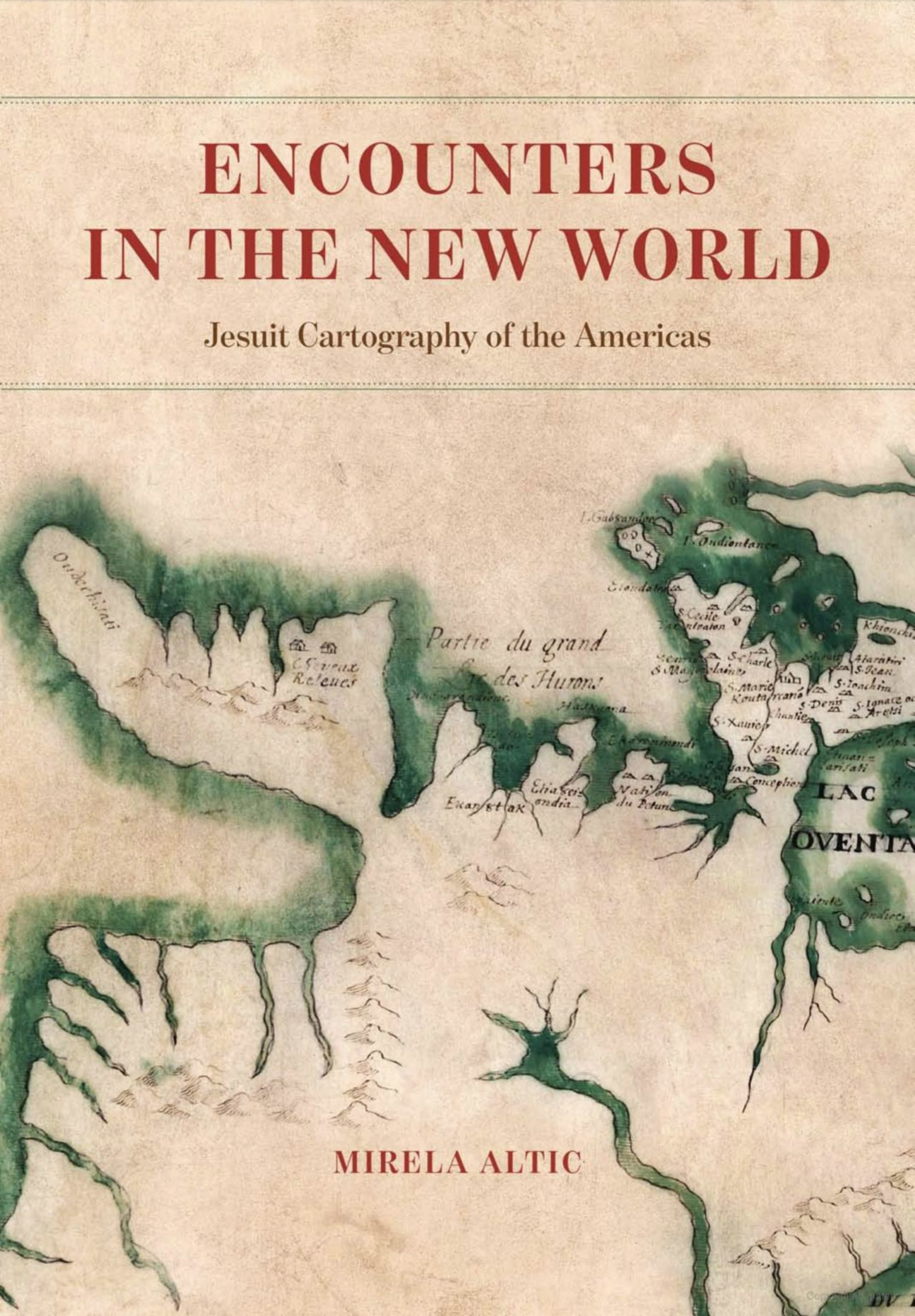
The much shorter chapters on Jesuit maps of the Portuguese and French possessions in the New World make clear that each empire had different rules for mapmaking, use, and diffusion. In comparison to the Spanish maps, there are only a very small number of surviving maps of Brazil. This is largely due to Portugal’s policies of secrecy that kept maps locked away from unauthorized viewers. Jesuit maps discoursed about border regions, the mining activities in the state of Minas Gerais, and the missions in both southern Brazil and the Sacramento colony along the banks of the La Plata River in present-day Uruguay. The first Jesuits in New France arrived in 1609, but their activity only began to thrive two decades later with the creation of new missions in Huronia—that land between Lakes Erie, Ontario, and Huron, today known as southern Ontario. There, they sustained their religious operations through the fur trade (293), and were in constant collaboration and conflict with indigenous nations such as the Huron and Iroquois. Most notably, it was a French missionary, Jacques Marquette, who, in 1673, drew one of the first maps of the Mississippi River in the lands between Lake Superior and the Gulf of Mexico.
The power of Encounters in the New World lies in its comparative analysis of the Jesuit maps. The author presents an insightful narrative of the complex processes of mapmaking and of the people involved in the process. Altic shares her enthusiasm about the maps, and writes: “I was particularly interested in the modalities of the transfer of information and the ways the information noted on Jesuit maps affected other maps—both within and beyond Jesuit cartography” (2). The meaning of this sentence becomes clear very quickly. The book’s rich illustrations (47 color plates and 121 black-and-white figures) reveal that, in the process of being copied and printed, the original manuscript maps underwent heavy editing—sometimes resulting in completely different maps—and the author shows how these transformed maps were inserted in broader cultural and political contexts.
Be prepared! The book is very dense and descriptive. It contains many passages with very specific and detailed information, lengthy descriptions, and a lot of names of people and places that will likely not ring any bells for the reader not already acquainted with the era, landscape, and persons involved. There were moments that I felt overwhelmed by the abundance of place names and persons listed in long sequences, and further explanations, or even a glossary at the end of the book, would have been welcome additions. I became particularly curious about the biographies of some of the Jesuit mapmakers and wanted to read more about them—beyond what can be learned browsing through the book’s 872 endnotes. It would also be useful for those interested in learning more about Jesuit cartography if there were an appendix with the complete list of maps used in the study, and the libraries and archives that hold them.
These days, writing almost anything on the activities of European missionaries in the Americas will court controversy and provoke diverse reactions and strong opinions, ranging from unconditional praise (as a substantial study on Jesuit cartography) to categorical condemnation (as downplaying of the devastating impacts of European colonialism in the region). Throughout this book—although always in the background—Altic keeps returning to one of the central points in her study, one also stressed in the title: encounters. She endeavors to examine the way that the Jesuits served as active agents connecting native peoples and European colonizers. Active connecting agents they surely were, but recollection of the brutality of the conquerors, and the fact that 90% of the native population of the Americas were wiped out by war and diseases in the first one hundred years after the arrival of the Europeans (Koch et al. 2019) may leave the reader with a bitter taste in their mouth.
Compared with other religious orders active in the New World, the Jesuits were skilled field workers and excelled in mapmaking, but the maps they made almost always served the colonial project: identifying, organizing, and controlling territories and peoples. Altic affirms that the fourth vow of the Jesuits—to spread Catholicism through their missionary work—played into the hands of the colonizers. It was “skillfully used by European imperial politics, so that the Jesuits, by spreading the gospel among the indigenous peoples of the New World and the maps they were to produce, would also become a powerful tool for establishing and maintaining the colonial authority of the European imperial powers” (17). It would be naïve to think that the Jesuits only ever wanted to know about space for the purpose of converting the natives to Catholicism when they were, in fact, so clearly an integral part of the larger colonial project.
Throughout her book, Altic frequently refers to “encounters” between natives and colonizers and stresses the Jesuits’ role as active connecting agents between the parties to these interactions. However, while European viewpoints are well represented, the indigenous voices remain strangely silent. Perhaps this is due to the scarcity of surviving native sources or simply because the intended focus is on European cartographic history, but there seems to be little about actual cross-cultural encounters or connections. While this focus is fine with me, I would have liked to read more about the “real” encounters between the missionaries and the local populations and how, and how much, indigenous informants contributed to the mapmaking. Great examples of this approach are Barbara Mundy’s path-breaking book The Mapping of New Spain (Mundy 1996) or, more recently, Ana Pulido Rull’s Mapping Indigenous Lands (Pulido Rull 2020; reviewed in Cartographic Perspectives 97). Both books point out that indigenous people played important roles as information sources and were even involved in the mapmaking itself. Lastly, the title of Altic’s book reminded me of two other books that focus on “cartographic encounters”: Malcolm Lewis’ 1998 anthology on Native American mapmaking and map use, published twenty-five years ago, and John Rennie Short’s 2009 study of indigenous peoples and the exploration of the New World. It surprised me that these references were not mentioned in her bibliography. None of this, however, takes away the merit of Altic’s exhaustive and meticulous work. As I mentioned above, her study is on Jesuits and their maps, not on indigenous peoples, although under the circumstances her title may be slightly misleading. An additional chapter on these intercultural encounters might have been in order, though I suspect that this theme would be worth a complete book by itself.
Altic’s study is Herculean. She clearly put so much work into it. It is a great reference book, especially for map historians and scholars specializing in Latin America and religious studies, though it is not always easily accessible to the general readership without expertise in these topics (including myself). A great strategy for reading would be to start by examining the color plates or black-and-white figures—many never before published—and comparing one’s own observations to the detailed analysis provided by the author.
In summary, Encounters in the New World is a valuable contribution to studies in the history of cartography and of the Americas, especially Latin America, between the mid 1500s and late 1700s. Besides being a thorough account of Jesuit cartography in the Americas, the book also literally invites the reader to an encounter with these fascinating maps.
REFERENCES
Koch, Alexander, Chris Brierley, Mark M. Maslin, and Simon L. Lewis. 2019. “Earth system impacts of the European arrival and Great Dying in the Americas after 1492.” Quaternary Science Review, 2007: 13–36. https://doi.org/10.1016/j.quascirev.2018.12.004.
Lewis, G. Malcolm, ed. 1998. Cartographic Encounters. Perspectives on Native American Mapmaking and Map Use. Chicago: University of Chicago Press.
Mundy, Barbara. 1996. The Mapping of New Spain: Indigenous Cartography and the Maps of the Relaciones Geográficas. Chicago: University of Chicago Press.
Pulido Rull, Ana Maria. 2020. Mapping Indigenous Land: Native Land Grants in Colonial New Spain. Norman, OK: University of Oklahoma Press.
Short, John Rennie. 2009. Cartographic Encounters: Indigenous Peoples and the Exploration of the New World. Chicago: University of Chicago Press.